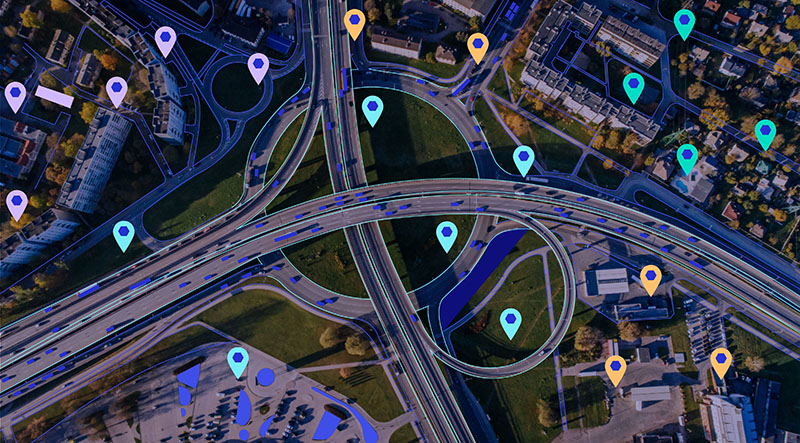
What Is Geospatial Technology?
Over the past few decades, new technologies have emerged at an unprecedented pace, and many have reshaped how consumers interact with the brands they engage with most. One component of this evolution, geospatial technology, is transforming the relationship between brands and their customers.
With that being said, what is geospatial technology and (perhaps more importantly) how can it help your business make informed, location-based decisions that promote growth and boost profitability?
Broadly speaking, geospatial tools and technologies are resources that can facilitate the mapping of our planet as a whole, and are powered by assets such as global positioning systems (GPS), geographic information systems (GIS), and remote sensing (RS) solutions.
At a more granular level, geospatial tools and technologies can provide deep, actionable insights about communities, cities, or larger demographics. The data gathered from geospatial technologies can be used to better understand target audiences, consumer segments, or customer trends in general.
Why Is Geospatial Technology Important?
If an organization is to thrive in a modern business environment, it must be agile, flexible, and data-driven. Geospatial technology will help your business embody these qualities by enabling you to create value from the information you already collect daily.
By conducting comprehensive analyses of location-based data through geospatial technologies, your business can:
Efficiently Process Information at Scale
Before effectively processing your data, you must unify and structure it. Geospatial technology — such as Foursquare Studio’s Hex Tiles — can accelerate this process by providing advanced analytics and robust data visualization tools.
With these technologies, you can analyze and interpret massive amounts of disparate geospatial information, gain real-time insight into consumer behaviors, and capitalize on emerging business opportunities. Ultimately, the data will facilitate continued growth and agility, even when you encounter unexpected challenges.
Visualize Complex Movement Trends
Optimizing movement is key to increasing business efficiency and productivity – a statement that holds true whether you need to streamline delivery processes or address friction in the front end of a supply chain. But to identify and subsequently resolve movement inefficiencies, you must be able to access timely location data readily.
Geospatial technology becomes critical here, as it allows you to visualize data in the context of time and space. You can then use these interpretations of temporal data to pinpoint trends, remedy the causes of resource waste, and promote business efficacy.
Quickly Make Location-Based Business Decisions
Traditionally, unifying and visualizing data would take weeks, or potentially months. By leveraging modern geospatial technologies, you can condense that process to just a few days, saving your business resources and budget.
Geospatial technology will accelerate your data analysis workflow. In turn, you can devote more of your time, energy, and resources toward sharing insights and weighing the potential impacts of location-based business decisions.
For instance, you can use the information obtained from geospatial technology to assess the viability of a new market or determine which markets represent the best expansion opportunities for your company.
What Industries Is Geospatial Technology Most Often Used For?
Geospatial technologies can deliver value to businesses operating across various industries. Just some of the sectors that could benefit from implementing geospatial tools and technologies include:
- Marine sciences
- Law enforcement
- Astronomy
- Healthcare
- Meteorology
- Tourism
- Ecology
- Navy
Here are a few more specific use cases for geospatial technology:
Marketing
Any business that engages in digital marketing serves to benefit from geospatial technology. These technologies can drastically enhance a company’s ability to deliver targeted ads to its various audience segments, and improved targeting capabilities can lead to increased leads and higher conversion rates.
Real Estate
Real estate firms can use geospatial technology to visualize their assets remotely. When used for this purpose, geospatial technology can streamline communications between real estate agents, buyers, and sellers. For instance, a real estate agent may use geospatial technology to provide a detailed map of a property to an out-of-state buyer to help them better determine whether an asset is a sound investment for them.
Telecommunications
The telecommunications sector can use geospatial technology to map out the deployment of new assets, such as expanding high-speed cables and conduits to new neighborhoods. They can also use these technologies to monitor and document the location of existing cabling and infrastructure.
Logistics
The logistics and transportation sector can streamline the tracking of goods, optimize delivery routes, and increase overall business optimization with geospatial technologies. This tech could be exceptionally beneficial for businesses delivering perishable items that must be distributed promptly to prevent spoilage.
Geospatial Technology Examples
Geospatial technology, such as Foursquare’s, is exceptionally versatile. Foursquare Studio’s suite of capabilities can be used to:
Enhance Mobile Apps
In 2022, wildly-popular mobile travel app The Points Guy partnered with Foursquare to provide its users with a location-driven mobile experience. As part of the partnership, The Points Guy integrated the Movement SDK into its mobile app, allowing the app to ensure that users are maximizing rewards by weighing rewards options and suggesting the optimal credit card to use for travel expenses, like hotel stays.
Facilitate Data Visualization
Kontur, a real-time risk management solutions provider is no stranger to the world of geospatial technology. However, the company wanted to enhance further its robust mapping and data visualization capabilities to share the environmental impact of worldwide wildfires.
To accomplish this, Kontur implemented a pair of Foursquare solutions: Studio Map SDK and Hex Tiles. Together, these capabilities allowed Kontur to visualize a huge dataset and create an interactive Global Fires map.
Guide Site Selection
Grounded in Foursquare Places, businesses can level-up their site selection process through the analysis of economic and foot traffic trends across 100M+ POI. Manifesting in Foursquare Studio – a powerful technology that can guide site selection when planning development projects – construction teams, engineers, and development stakeholders will find detailed geospatial visualization solutions to find the perfect site for building assets. The information provided by Foursquare can be used to decrease project costs and avoid unexpected geographical challenges.
How Foursquare Brings Geospatial Technology to Life
Geospatial data can be extremely valuable to your decision-making processes. With Foursquare, you can tap into real-time data with our geospatial technology and bring insights to life. Our solutions transform massive amounts of geospatial data into easy-to-digest visual content you can share with your team.
One of the critical advantages of Foursquare and our geospatial technology is its versatility. Our flexible, advanced platform can seamlessly integrate into your existing tech suite and business processes, meaning it can adapt to the needs of your business, regardless of the industry where you operate.If you would like to learn more about how Foursquare Studio’s dynamic geospatial technology can revolutionize the way you make location-based decisions, we invite you to connect with an expert or explore our suite of products. Whether you have questions about pricing, products, or use cases for our tech, we have team members prepared to answer them.


