Desktop GIS meets Web!

Unfolded has launched a new Unfolded QGIS plugin that enables QGIS users to seamlessly use QGIS data in the Unfolded platform.
This new QGIS plugin builds a bridge between the desktop-based QGIS tooling and the web-based Unfolded platform, enabling a range of new use cases for both the QGIS community and Unfolded users.
Enabling new use cases
The Unfolded platform offers next-generation geospatial visualization and analytics on the web, providing unique GPU powered visualization capabilities in your browser.
QGIS is the leading open GIS software for desktops, supporting a wide range of platforms, including Linux, Unix, Mac OSX, Windows and Android. QGIS supports numerous vector, raster, and database formats and functionalities. You can visualize, manage, edit and analyze data as well as compose printable maps.
The two platforms offer highly complementary functionality.
The QGIS community can now easily access and integrate with Unfolded’s powerful web-based platform, which enables simple publishing of QGIS maps to the web and access to many additional advanced visualization and analytics features.
Unfolded users can now leverage the powerful cartographic capabilities of QGIS. Even more importantly, it opens up a huge range of QGIS data manipulation tools and processing functions for users before they import their project to Unfolded Studio.
Integration Workflow
Here is an example of how a combined QGIS and Unfolded workflow might look:
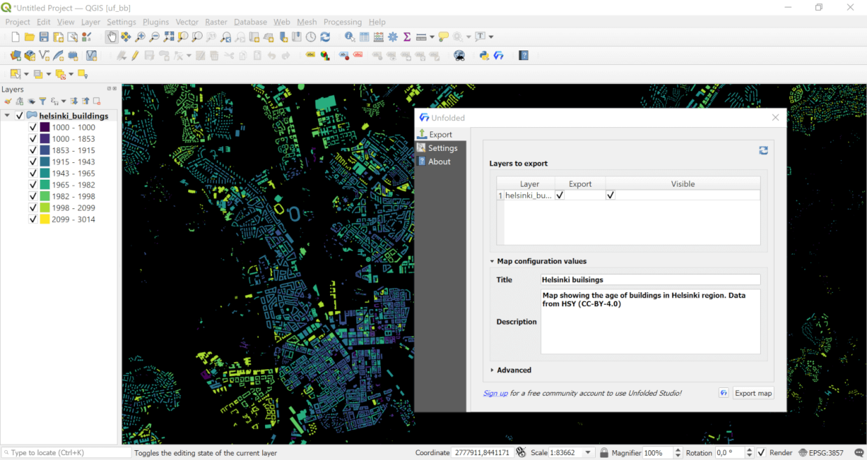
1. Open QGIS and install the plugin. Note that you must be using QGIS v3.16 or later. Please upgrade your QGIS installation if the plugin does not show up in the QGIS plugin manager.
2. Add data to your QGIS project.
3. Modify your data in QGIS if needed. You can use some of the processing algorithms or combine it with other datasets.
4. Style your QGIS map the way you want using the standard styling options in QGIS. To help you visualize how the exported map will look, you can show the default Unfolded Studio basemaps inside QGIS from the Settings tab.
5. Export your map to disk (saved as a zip file).
6. Click the plugin import button to open the Unfolded Studio import dialogue and import the map.
7. Admire your exported QGIS map in your web browser in Unfolded Studio.
8. Publish your map to the web in Unfolded Studio and share the URL on social media.
Optionally, you can now use the Unfolded Map SDK to quickly build a custom web application on top of your map.
Data manipulation in QGIS
You can add data to QGIS, in any format supported by the GDAL OGR drivers. Let’s stop here for a while, because this is huge. Currently Unfolded Studio has been able to read CSV, JSON, GeoJSON, and Shapefile formats. This plugin opens up a new pipeline, including GPX files, KML files, FileGDB, GeoPackages or PostGIS formats. All this without writing a single line of code. The plugin can also handle data in any coordinate reference system as everything is reprojected to WGS84 automatically when the project is exported.
Even bigger datasets
While Unfolded Studio can load large datasets directly into the browser, QGIS takes it up another notch. As QGIS is a desktop application running on your local machine, it can read very large datasets. Rendering the data might take a while, but QGIS allows you to pre-process your data before you export it to Unfolded Studio. For example, the map below showing internet download speeds in France is combined from several open datasets from Ookla. In a PostGIS database, the global data was 6.1 gigabytes, but QGIS makes it easy to extract only the necessary data to Unfolded Studio. The final output was only 24 megabytes, which performs well in web environments. View the full map here.

Data pre-processing in QGIS
With QGIS you can simplify detailed geometries and drop unnecessary columns from your data. Any way you can make your data smaller when doing your import makes it run smoother in the browser.

You can of course do geospatial analytics on your data (e.g. clustering) using Unfolded Studio. However, QGIS takes geospatial analysis to a whole new level. You can use the huge range of geographic functions in QGIS thanks to providers like GEOS, GDAL, GRASS and SAGA and all the plugins available. For example, you can do joins, simplifications, geometric operations (buffer, clipping) or converting raster data to vectors. With the plugin, you can either import one dataset or multiple layers from your project.
QGIS styling is preserved on the Web
The cartographic capabilities of QGIS are vast, but the typical output from QGIS is a static map. The Unfolded platform bridges this gap. The styling in QGIS can quickly become very complex, and an important responsibility of the plugin is to handle the mapping of your QGIS styles to the web. In the first release of the plugin, supported styling options include point, line and polygon geometries and simple styles (fills and strokes) for these. Categorized and graduated styling in QGIS is supported and, if you create a custom color palette for your data, that is automatically exported to your Unfolded Studio map.

How to get the plugin
You can download and install the Unfolded plugin from the official QGIS plugin repository of QGIS, or directly from GitHub.
As the plugin is open source, all development ideas regarding the plugin as well as contributions are very welcome. Join our community to give input and share your thoughts.
Background
The Unfolded plugin was developed as a collaboration between Gispo Ltd and Unfolded.


