
Add Tiled Dataset
Studio allows you to access tiled data from a range of tiled and raster formats, including Vector tiles, Cloud Optimized GeoTIFF, and other common formats.
3D tiles may also be rendered in Studio. Details about how to specify URLs and how to retrieve an api key / access token is provided on a separate page.
Note: Your tiled data sources must be available via URL to use them in Studio.
Add a New Tiled Dataset to Studio
Follow the steps below to add a new tiled dataset to Studio:
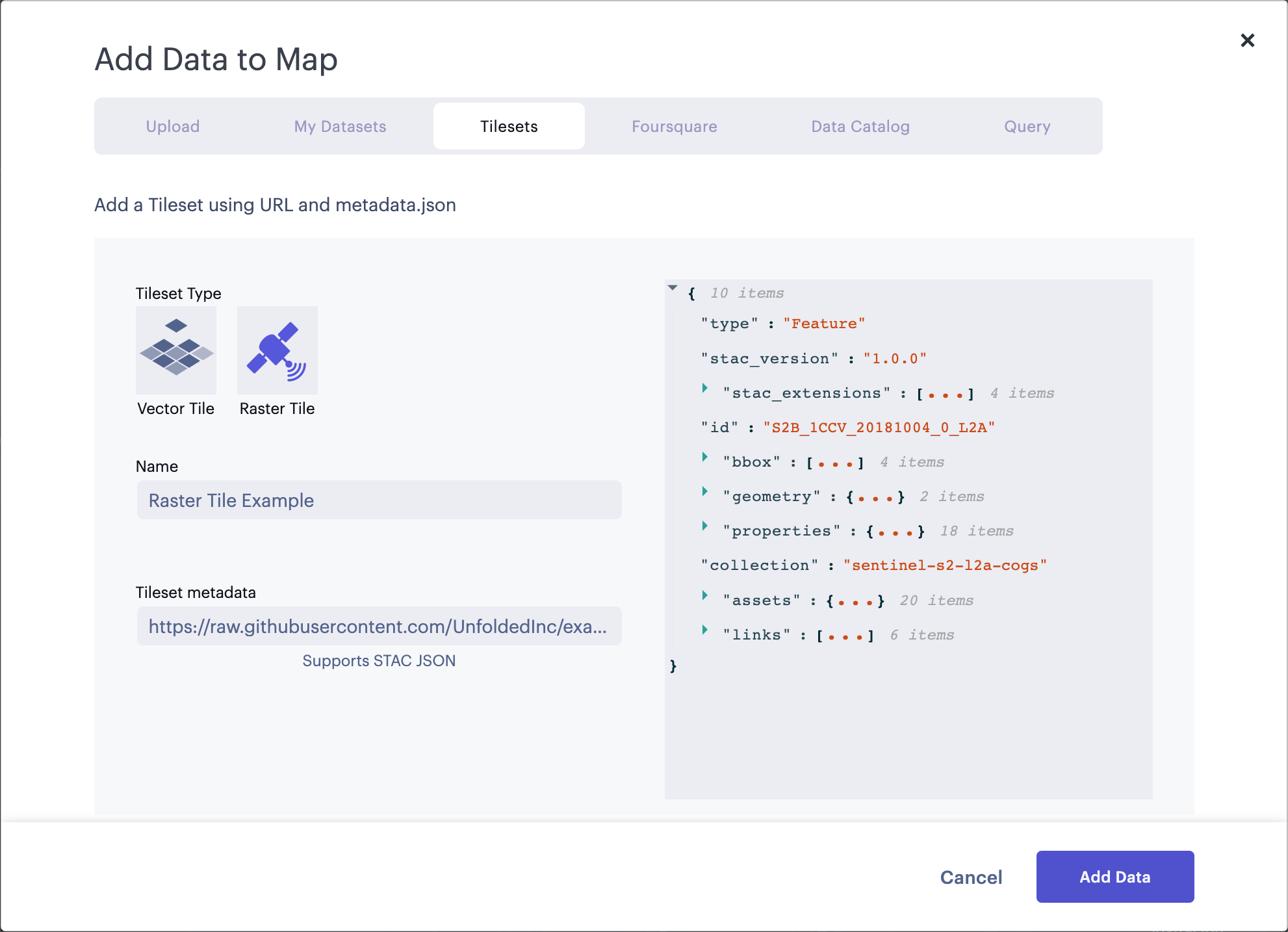
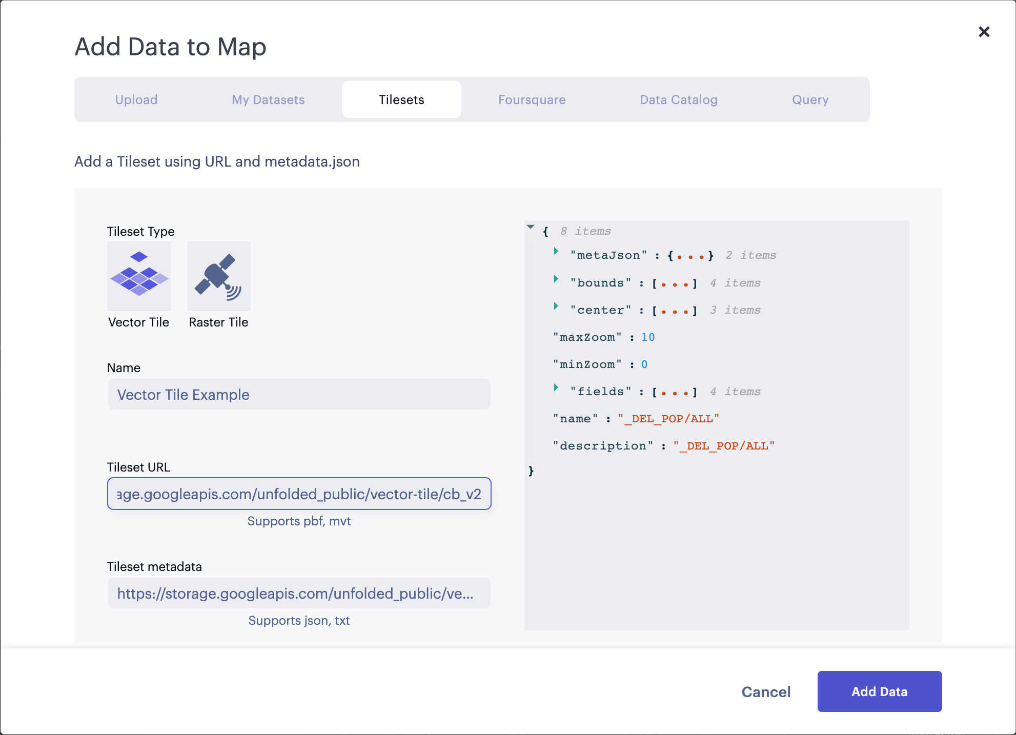
1. Click the Add Data button, then navigate to the Tilesets tab.
2. Under Tileset Type, select either Vector Tile, Raster Tile, WMS, or 3D.
| Tile Type | Information |
|---|---|
| Vector Tiles | Paste the tiled dataset URL in the Tileset URL field. Studio will automatically fetch the metadata file, then generate a name for the tileset and a preview of the JSON file. Learn more about the Vector Tile data format and the Vector Tile layer. |
| Raster Tiles | Paste the tiled dataset metadata URL in the Tileset metadata field. Studio will generate a name for the tileset and a preview of the JSON file. Learn more about the Raster Tile data format (COG) and the Raster Tile layer. |
| 3D Tiles | 3D tile URL and API keys are service dependant. See the 3D tiles page to learn more. |
| WMS | Paste your dataset's URL into Service URL (Optionally, copy and paste the demo WMS URLs listed below the field). Provide a name for the WMS dataset in the Name field. Learn more about the WMS format and the WMS layer. |
Note: Raster tile data must reference a Cloud-Optimized GeoTIFF (COG), which requires standardized Spatio-Temporal Asset Catalog (STAC) metadata.
3. Click on Add Data button to add the new dataset.
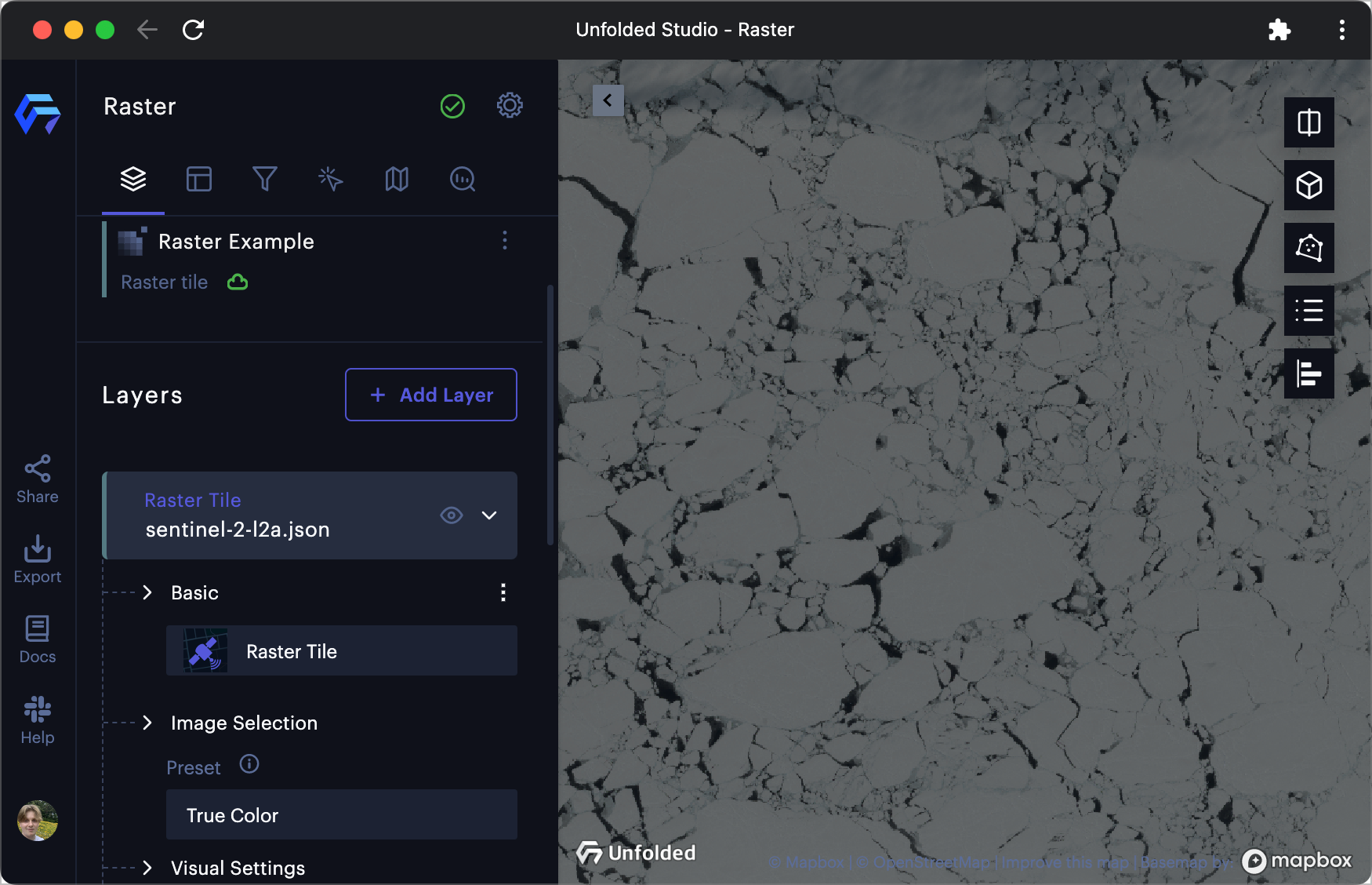
A new tiled layer will be automatically generated and displayed on your map. You may need to zoom in to display the tiles, as your tileset may have a minimum zoom level greater than the default zoom level.
To learn how to configure this layer, visit the Vector and Raster layer reference pages.
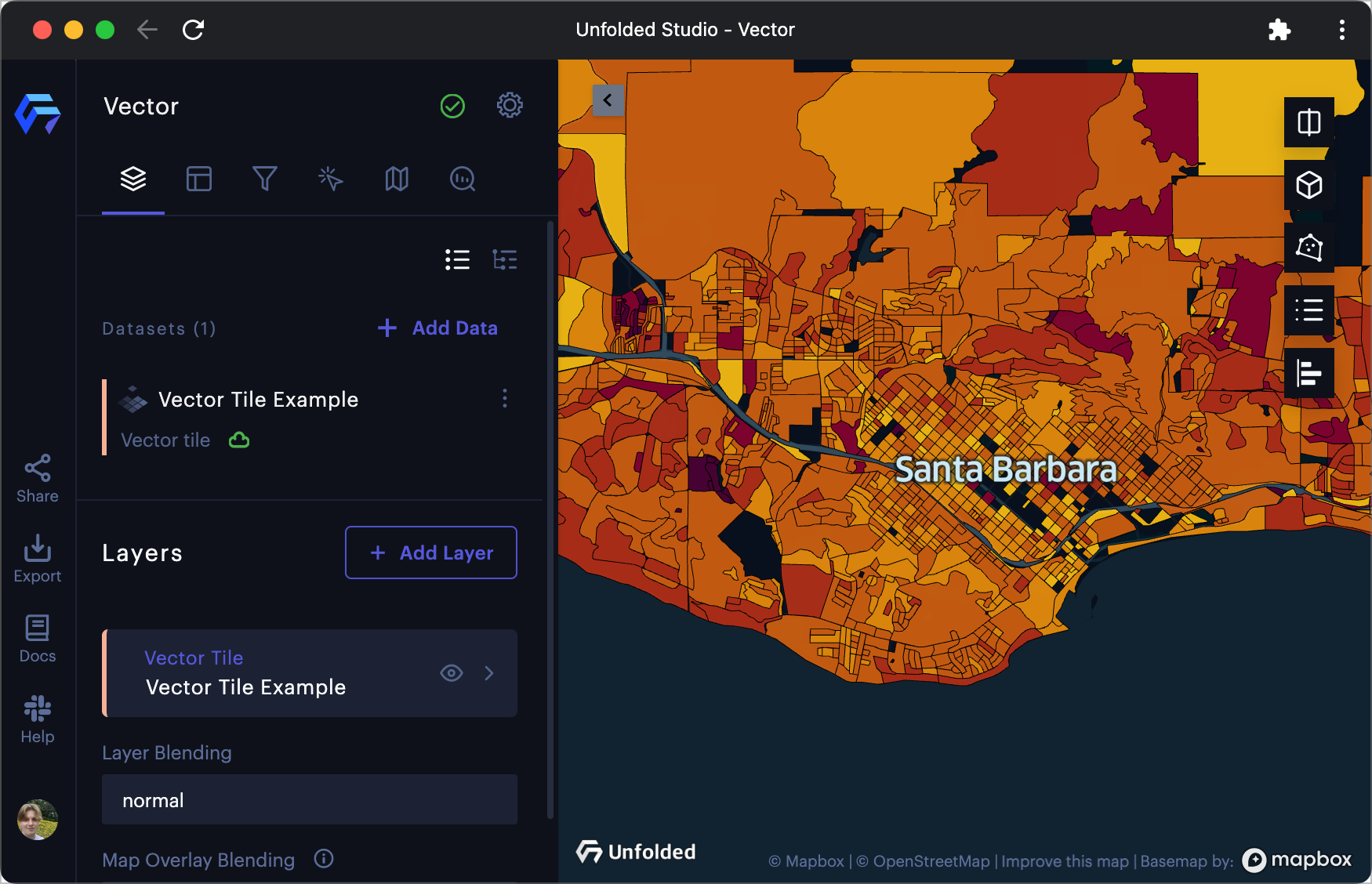
Bottom: A Vector tileset showing census areas.
Custom COG Requirements
Raster layers can reference user-provided, custom Cloud-Optimized GeoTIFFs (COG) by providing standardized Spatio-Temporal Asset Catalog (STAC) metadata.
STAC metadata requirements
- The metadata file must be a valid STAC Item, version 1.0.0 or higher. STAC Collections and Catalogs are not currently supported.
- Raster data referenced in STAC assets should be Cloud-Optimized GeoTIFFs and need to be publicly accessible via HTTPS.
- STAC item must have Electro-Optical and Raster extensions, and at least one asset must have both
eo:bandsandraster:bandsinformation.common_namemust be provided ineo:bandsanddata_typemust be provided inraster:bands.
Example Raster Tilesets
You can test raster tiles using resources from our public GitHub repository.
Updated about 2 months ago