
WMS Layer
![]()
The WMS Layer lets you connect Studio with Web Map Services (WMS) to render map images optimized for the current view. Instead of downloading a detailed map of the entire globe, an image is rendered covering the current viewport.
In contrast to the Vector Layer and Raster Layer which build up the map image by loading many smaller image tiles, the WMS Layer loads a single image that covers the entire viewport in one single request and updates the image by performing additional requests as the viewport changes.
To use this layer, an image source must be specified. Image sources are specified by supplying a URL to the WMS Layer's Data property. See the section on image sources below for more information.
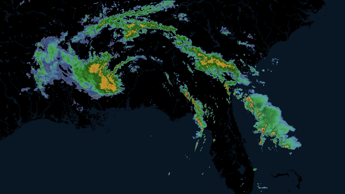
An example of the WMS layer displaying a storm.
Add WMS Data
When creating a new map or adding data to the map via the Add Data button, you are brought to the Add Data to Map page.
From this page, navigate to the Tilesets tab, then select WMS. If you have a URL hosting your WMS dataset, paste it in the Service URL field. If you do not have a WMS dataset, copy and paste any of the examples listed below the Service URL field.
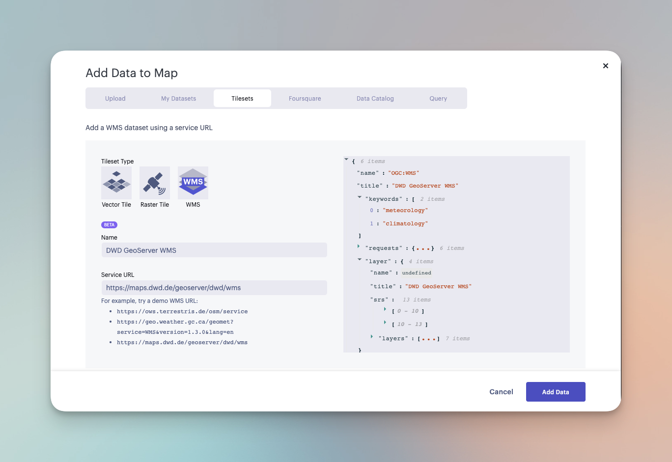
Sample WMS data configuration.
Sample WMS Datasets
The following table contains several sample WMS datasets. You can paste the URL into the Service URL field to load the dataset.
Note: Foursquare does not manage these assets and is not responsible for their quality or reliability. Visit the linked websites to learn more about these datasets.
| Name | Service URL | Description |
|---|---|---|
| OpenStreetMap WMS | https://ows.terrestris.de/osm/service | OpenStreetMap rendered, updated weekly, covering the entire globe. Copyright OpenStreetMap. |
| NOAA Composite Reflectivity WMS | https://opengeo.ncep.noaa.gov/geoserver/conus/conus_cref_qcd/ows | Radar precipitation data covering the contiguous US. Quality Controlled 1km x 1km CONUS Radar Composite Reflectivity. This data is provided Multi-Radar-Multi-Sensor (MRMS) algorithm. |
| NASA Global Imagery Browse Services for EOSDIS | https://gibs.earthdata.nasa.gov/wms/epsg4326/best/wms.cgi | Over 1,000 NASA satellite imagery products, covering every part of the world. Most imagery is updated daily—available within a few hours after satellite observation, and some products span almost 30 years. |
Settings
Upon adding a WMS dataset to your map, a new layer will automatically be created. Its configuration options can be found in the left-hand sidebar. Click the layer panel to open the configuration settings.
Basic
The first section contains the most fundamental elements of the WMS Layer. Click Basic to expand the settings.
| Setting | Description |
|---|---|
| Layer Type | The type of layer. Must be set to WMS to render WMS data. |
| Dataset | Select a WMS dataset to use for the selected layer. |
Service
Image servers such as WMS can render different map "layers". One or more map layers must be specified, otherwise requests for map images will fail.
Studio attempts to load the layer list from the WMS service and uses the first layer in the list if none is specified.
| Setting | Description |
|---|---|
| Layers | The WMS service layer to use for the service. Scroll or search for the desired layer. |
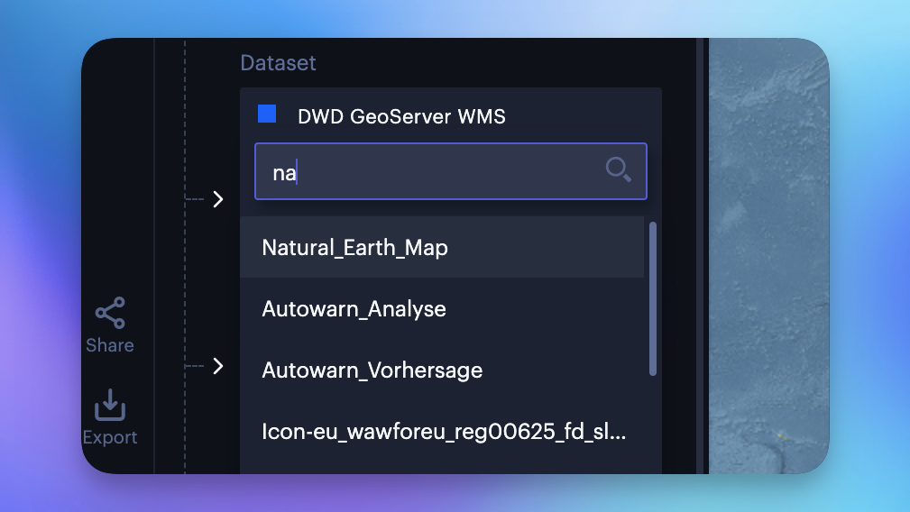
Selecting a layer from the WMS dataset.
Appearance
The appearance section contains the opacity slider. When creating several WSM layers in Studio, ordering layers and modifying their opacity helps to create a clear composite image.
| Setting | Description |
|---|---|
| Opacity | The opacity, or transparency of the map. 100 = fully opaque, 0 = fully transparent. |
WMS Metadata
Image services like WMS can often provide metadata (aka capabilities) about the service, listing;
- attribution information,
- available layers,
- additional capabilities (pixel/neighborhood queries, legend generation, etc.)
The WMS Layer will automatically attempt to query metadata for WMS. This metadata can be inspected when adding the WMS service, and can be accessed by expanding the JSON schema viewer. If there is an error while loading the WMS metadata, an error message will appear describing why the layer could not be generated.
Map Configuration
For details on how to programmatically specify layer properties, refer to the Layer Configuration specification.
Updated 4 months ago