
Map View Modes
Studio provides a selection of view modes that offer different perspectives on your data.
Map View Modes:
- 2D View - A flat 2D overhead view that can be panned and zoomed but not rotated. This mode offers a more traditional cartographic view of your data.
- 3D View - A 3D perspective view that can be rotated and tilted, providing users with a more engaging way to interact with your data, especially if your visualizations are extruded or have 3D components.
- Globe View - A 3D globe view of the Earth. This mode is most effective for large (continental or planetary) data sets.
Note:
All map settings are saved and preserved when publishing maps.
Change the view of your map by clicking the Map View icon in the top right corner of your map and selecting one of the options:
Upon selecting map view, you are given three options for the map view.
2D View
2D View is the default view mode in Studio, providing a simple top-down view of the map.
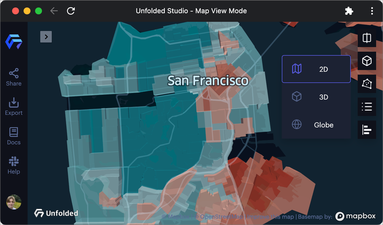
2D View example.
3D View
3D View provides increased visibility of visualization elements with height, such as 3D buildings and extruded data points.
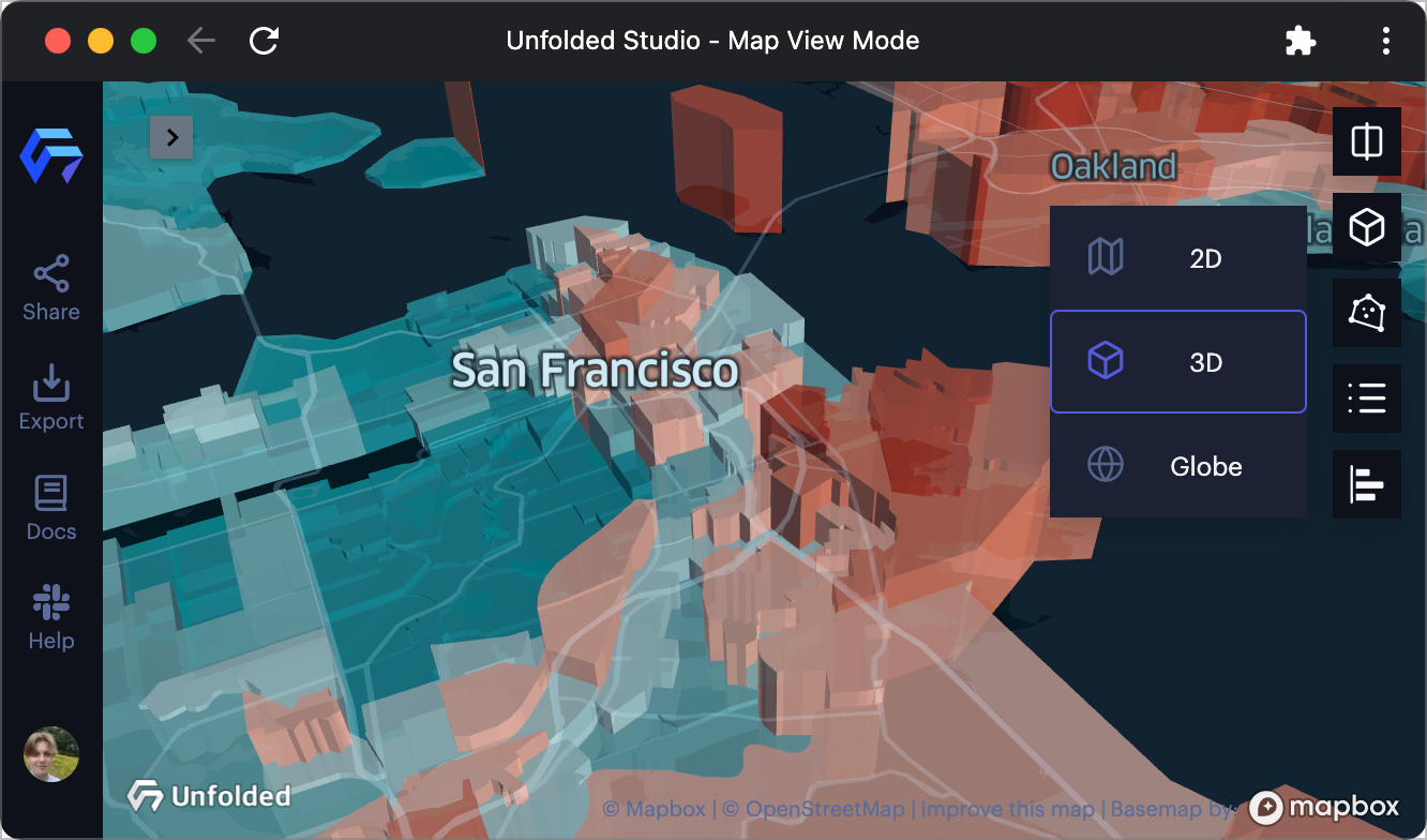
3D View example.
While in 3D View, you can hold Command ⌘ on Mac or Control on Windows to rotate the map.
Globe View
Use Globe View to provide users with the benefits of 3D view while exploring the Earth.
After Globe View mode is selected, you can customize it Base Map > Globe.
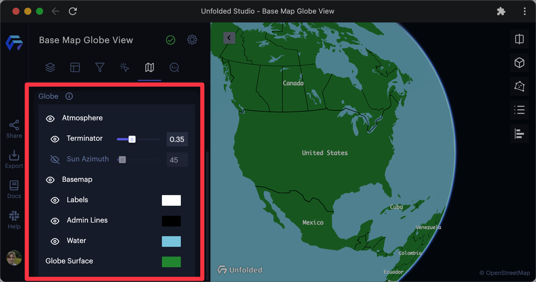
Globe settings in the Base Map tab.
The following options can be changed:
| Option | Description |
|---|---|
| Atmosphere | Click to enable/disable terminator and sun azimuth. |
| Terminator | The terminator is a line that separates day and night on the Earth. Increase the slider to further darken the night side of Earth. |
| Sun Azimuth | The sun azimuth is the angle at which light is projected on Earth. Increase/decrease the slider to change the position of the azimuth. |
| Base Map | Click to enable/disable the base map. |
| Labels | Click to enable/disable the display of labels in globe view. Click the color box to choose a new color. |
| Admin Lines | Click to enable/disable the display of admin lines (such a state and country borders). Click the color box to choose a new color. |
| Water | Click to enable/disable the display of bodies of water. Click the color box to choose a new color. |
| Global Surface | Click the color box to choose a new color for the Earth's surface. |
Updated over 1 year ago