
3D Tile Layer
![]()
Studio supports the rendering of massive 3D datasets in the 3D Tiles format, e.g. providing photorealistic renderings of hundreds of cities across the globe via Google Map Tiles. These massive 3D datasets are optimized for streaming, analytics, and time-dynamic simulations.
Large-scale 3D data allows businesses to model and visualize their operations in a realistic setting that mirrors the real world.
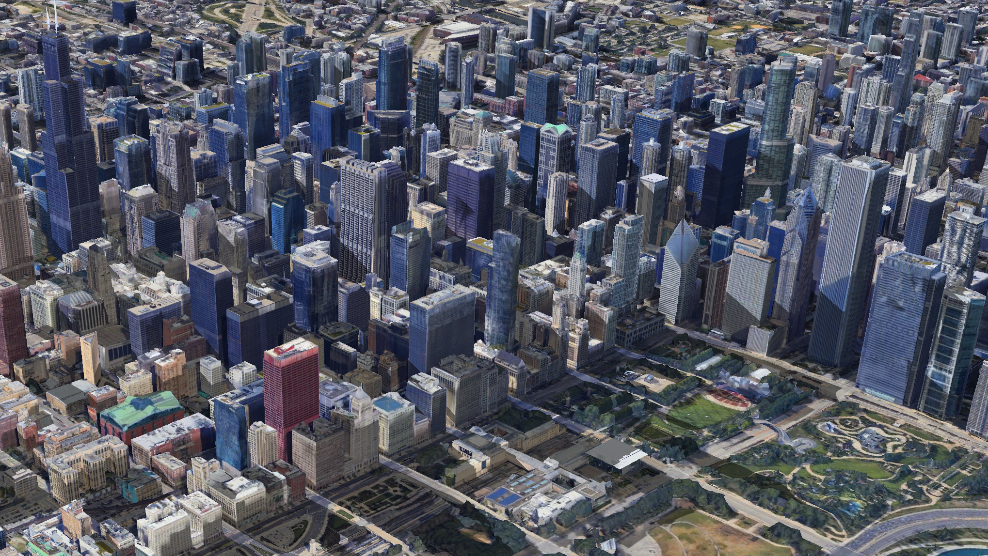
3D Tile Layer showing Chicago.
Add 3D Tile Data
The process of adding 3D tile data to your map varies from source to source. Learn more about adding 3D Tile data to your map.
Settings
Upon adding a 3D Tile layer to your map, a new layer will automatically be created. Its configuration options can be found in the left-hand sidebar. Click the layer panel to open the configuration settings.
Basic
The first section contains the most fundamental elements of the 3D Tile Layer. Click Basic to expand the settings.
| Setting | Description |
|---|---|
| Layer Type | The type of layer. Must be set to 3D Tile to render 3D Tile data. |
| Dataset | Select a 3D Tile dataset to use for the selected layer. |
Appearance
The appearance section contains the opacity slider. When creating several WSM layers in Studio, ordering layers and modifying their opacity helps to create a clear composite image.
| Setting | Description |
|---|---|
| Opacity | The opacity, or transparency of the map. 100 = fully opaque, 0 = fully transparent. |
Map Configuration
For details on how to programmatically specify layer properties, refer to the Layer Configuration specification.
Updated 4 months ago